Earth Monitoring

iXblue Earth Monitoring iXblue Earth Monitoring

Seismology, volcanology, ground tomography, reservoir monitoring, geodesy, sub-surface imaging for civil engineering… We provide a range of consistent solutions to universities, agencies and laboratories worldwide to address their growing challenges and carry out their Earth Monitoring projects. Offering proven performance and reliability on the field, even in volcanic environments, our versatile solutions can address wide range of applications, powering flexible and cost-effective operations.


#

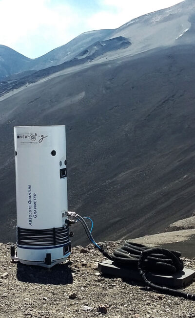
Absolute Quantum Gravimeter

Turn-key transportable quantum gravity sensor for reservoir monitoring, hydrology, seismology and civil engineering

See more

SeapiX-R

3D sonar for underwater gas bubbling monitoring

See more

Delph Subsea positioning

Subsea operations supervision Software

See more

Hydrins

High-grade Inertial Navigation System (INS) for hydrographic surveys

See more

Gaps series

USBL systems for subsea asset positioning and tracking

See more

Canopus

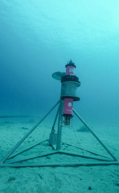
Intelligent LBL transponders for rift monitoring

See more

Ramses

Intelligent LBL transceivers with modem capabilities

See more

Groundbreaking Solutions for Earth Monitoring

Gravimetry

A free-fall absolute gravimeter based on laser-cooled atoms

Exail Absolute Quantum Gravimeter (AQG) is the first commercially available turn-key transportable quantum sensor for high-precision gravity measurements.

It offers very attractive features for high-precision gravity measurements:

  • absolute gravity measurement at a level of 10-8 m/s2 (1 μGal) in terms of sensitivity, stability and repeatability
  • continuous data acquisition from a few seconds to several years
  • transportable device allowing to perform surveys, time-lapse measurement of a network of reference stations or stationary measurements with the same instrument

Learn more


The AQG is highly suitable for a wide range of applications such as geophysics reservoir monitoring, geodesy, metrology and sub-surface imaging for civil engineering. It has proved its value for volcanology during a year-long field campaign on Mount Etna.

#

Data collected by the Absolute Quantum Gravimeter and the MEMS gravimeter will be analyzed and combined with models and other sensors. Because gravimeters are sensitive to deep mass changes, they are seen as promising candidates to detect early signs of eruptions, when the magma is still far from the surface.
Volcanic Degassing

Volumetric sonar for high precision forecasting of underwater volcanic environments

SeapiX-R is a solid-state 3D multibeam sonar that provides accurate water column coverage and seabed mapping. It brings new insights to the scientific community for the evaluation and the monitoring of underwater volcanic environments.

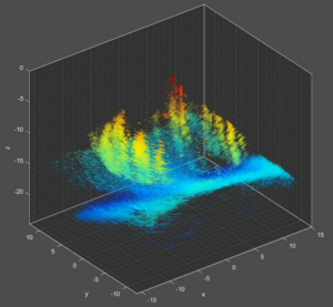
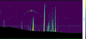
SeapiX-R Mills Cross configuration enables both arrays to alternately act as a transmitter and a receiver. Its steering capability scans, in real time, an entire volume of water column at 120°x120°. This enables full observation of the various elements found in the water column such as gas bubbling. SeapiX-R provides metrological target strength (TS) and volume backscattering strength (SV) of bubbles on multiple swathes. The obtained backscattering of bubbles mirror the gas dynamic into the volcano available from continuous observation of gas flares. As a static hydroacoustic monitoring platform, SeapiX-R can thus act as a powerful early warning system for volcanic eruptions.


Learn more about SeapiX-R

4D monitoring of gas flares using SeapiX in static positioning
Gas flares from the Laacher See volcanic lake (Germany)

Rift Monitoring

Advanced acoustic systems for faults monitoring

Exail Canopus transponders offer high-accuracy acoustic positioning systems for long-term geodetic operations. Particularly suited for tectonic plates or crustal deformation monitoring, they enable better characterization of faults behaviors and give access to valuable information on seismic risks.

Placed on each side of the faults, they measure the travel-time to one another to precisely determine their mutual distance, and thus the fault’s behavior. Featuring underwater acoustic communication between transponders, transceivers and surface equipment for advanced data retrieval, they also embed environmental temperature, pressures, sound velocity and inclinometer sensors.

Their capabilities (corrosion prevention, external sensor management, extended lifetime option) make it the best underwater fault monitoring solution in terms of accuracy, reliability, and ease of use.

Designed for geodetic applications:

  • Extended life time option
    • Lithium battery pack for 4-year deployments
  • Sensors management
    • Interface with high-accuracy external temperature sensor
    • Measurements synchronized with ranges
  • Corrosion prevention
    • Anodes kit and appropriate materials for release hook and protective guards

Learn more about Canopus

Why You Should Choose us?

Strong track record

Exail products have gained notoriety, especially among universities, agencies and laboratories through research collaborations & partnerships. They are designed and developed in close collaboration with key end-users (i.e European projects and joint research labs with prestigious academic/industry partners). Exail solutions are recognized for their reliability, their capability in providing exquisite performance and their suitability for a wide range of operations.

Ease of use and complementarity

At Exail, we know that the man-machine interface is a predominant factor in ensuring best use and the resulting performance of any system. We design the most intuitive and clear interfaces in order to facilitate system installation, integration and operation and, ultimately, make the most of the system’s capabilities. User-friendly display layouts are standardized on all products for optimization purpose. The coherent & complementary approach used to develop Exail wide range of products provide consistent solutions for advanced Earth Monitoring.

Experienced support experts

Reliability, together with a minimal level of preventive maintenance are key principles that govern Exail’s technical choices in systems design. In addition, Exail offers a 24/7 technical support service worldwide to guarantee the highest level of system operability for its customers. Recognized for their readiness and proficiency, they are trained on all Exail products you will be deploying and will be at your side from integration to advanced training and assistance, making sure your operation stays on track.

Learn more about our Support

Brochures and datasheets

Brochure Earth Monitoring

(2 MB)
Download

Brochure Absolute Quantum Gravimeter

(2 MB)
Download
Download all files

Bibliography

Earth Monitoring bibliography

(889 KB)
Download
Download all files