Subsea Positioning Software

Delph Subsea Positioning

Get more information with

Linkedin account

Viktor Stark

Product Manager
# #

Delph Subsea Positioning is an intuitive and dynamic software package used to plan, operate and post-process iXblue subsea positioning products. Integrating the full range of iXblue subsea systems, Delph Subsea Positioning (Delph SP) simplifies the planning, simulation, operation and post-processing of subsea positioning tasks. Comprising three intuitive and user-friendly core modules, Delph SP is an easy-to-use yet powerful tool enabling even the most complex subsea operations by making each step of the subsea positioning operation simpler, error-free and faster, saving vessel and man time.

LBL Array Planning Module

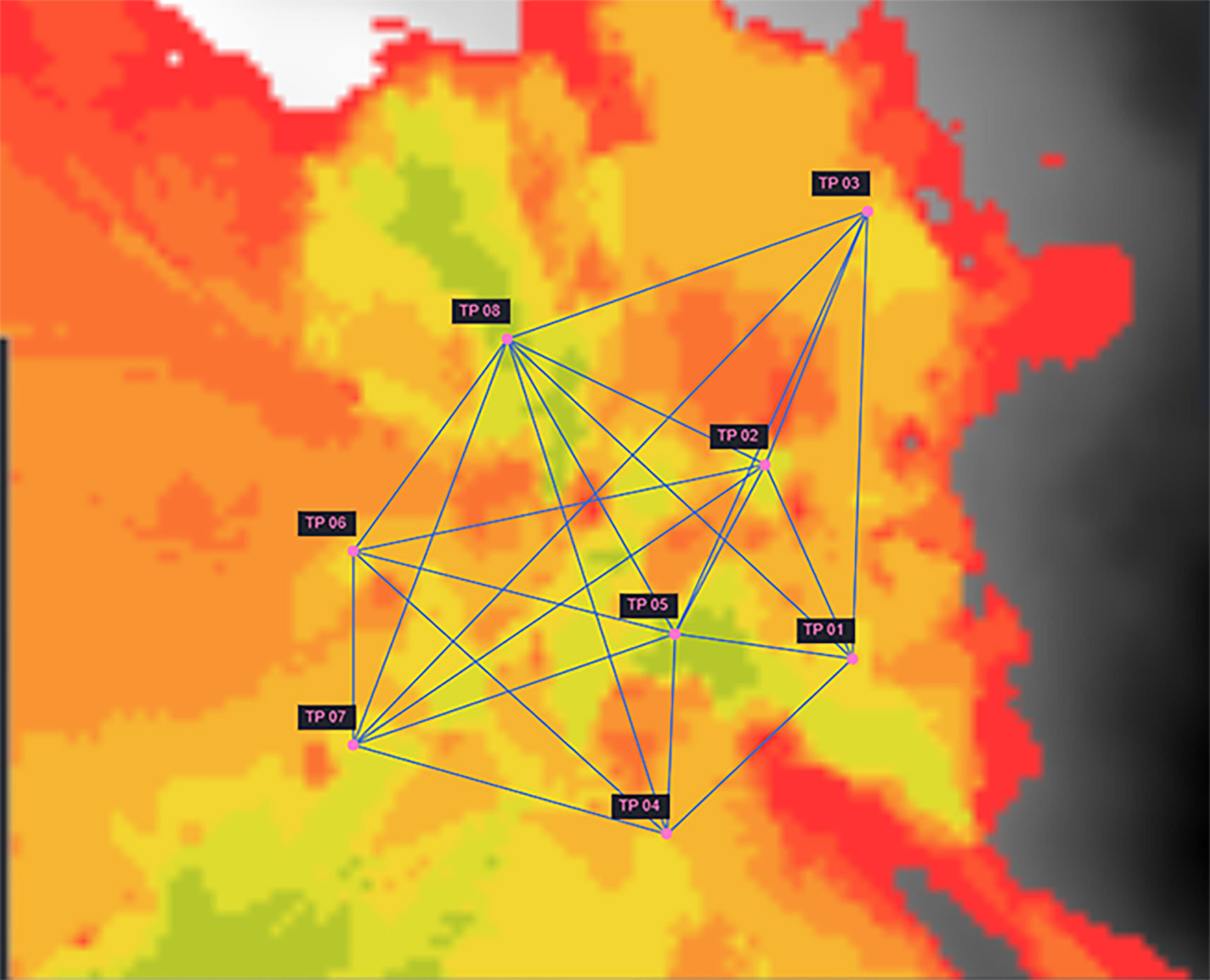
Deciding on the exact number and location of transponders to be deployed on the seabed is critical to the success of Long Baseline (LBL) operations. Therefore, careful and efficient planning is key. Dedicated to the planning of LBL missions, the LBL Array Planning module analyses acoustic propagation by taking into account seabed topography and Sound Velocity Profiles. It produces a real-time visibility map for a transceiver navigating in an array of transponders by estimating the acoustic coverage of each transponder. The LBL Array Planning module also checks for baselines and acoustic line of sights between transponders.

Operations Module

Once the planning and navigation simulation steps are completed, the operators know how many transponders are needed, both for sparse-LBL or conventional LBL, their precise location and the optimum navigation pattern. Operators can then start deploying the beacons. During this deployment phase, the Operation Module controls and commands all iXblue equipment in a single interface. It supervises all the operations, from equipment configuration, calibration tasks and standard positioning jobs, to specific telemetry operations and tracking operations monitoring. For the calibration of LBL arrays, the Operation Module runs state-of-the-art algorithms and produces automatic calibration reports. Calibration may be conducted via traditional GNSS aided box-in, SLAM and/or mutual array calibration methods.

Post-Processing Module (Delph INS)

Finally, Delph INS is the post processing module that completes the Delph SP suite. This module takes either real inertial data or data generated by the Navigation Simulation module (coming soon) and runs Inertial Navigation System algorithms to provide statistics and status all along the navigation (or simulated navigation). It also generates automatic report regarding the navigation of the vehicle. Strong data management, highly intuitive visualization, editing and processing features, together with diverse export capabilities make the Delph INS post-processing module ideal for quick and easy navigation enhancements. By combining the raw data from the INS and from the complementary aiding sensors (GNSS, USBL/LBL, DVL, depth sensor…) during post-processing, the Post-Processing Module provides higher accuracy for the position, velocity or attitude of the vehicle. The module also produces new comprehensive quality analysis and quality check reports (QA/QC), providing quick, easy and highly intelligible information on the reliability of the collected data.

Downloads

Delph Subsea Positioning Software – Datasheet

(860 KB)
Download

Subsea Positioning Brochure

(1 MB)
Download
Download all files